Up on the Moors June 9th 2019

roseberry topping

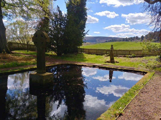
This fantastic walk took us way down south to the North Yorkshire moors – a rare outing south of the Tees for us. It meant a bit of a drive from Northumberland, but as we have members of our group in that neck of the woods it felt only fair to have a walk or two on their doorstep.

We met at the idyllic Kildale Railway Station, just east of Easby. It looks like a rural station that has somehow escaped the ravages of Beeching’s modernisation – regular trains still ply this stretch of line right along to Whitby. The plan for the walk was to catch the train to Great Ayton, where Captain Cook spent his childhood and where there is a small museum dedicated to him. Afterwards, we would walk back to Kildale. However, the walk leaders found out that the Captain Cook museum did not open until 1pm and so we would not be able to visit if we went straight there at 11:00.

Change of plan.

The new plan was to walk to Great Ayton, over the moors and then the walk leader would get the train back to Kildale Station and drive back to Great Ayton to ferry us back to our cars at Kildale (there was only five in total).

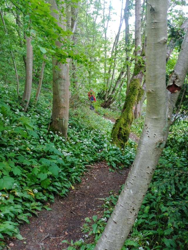
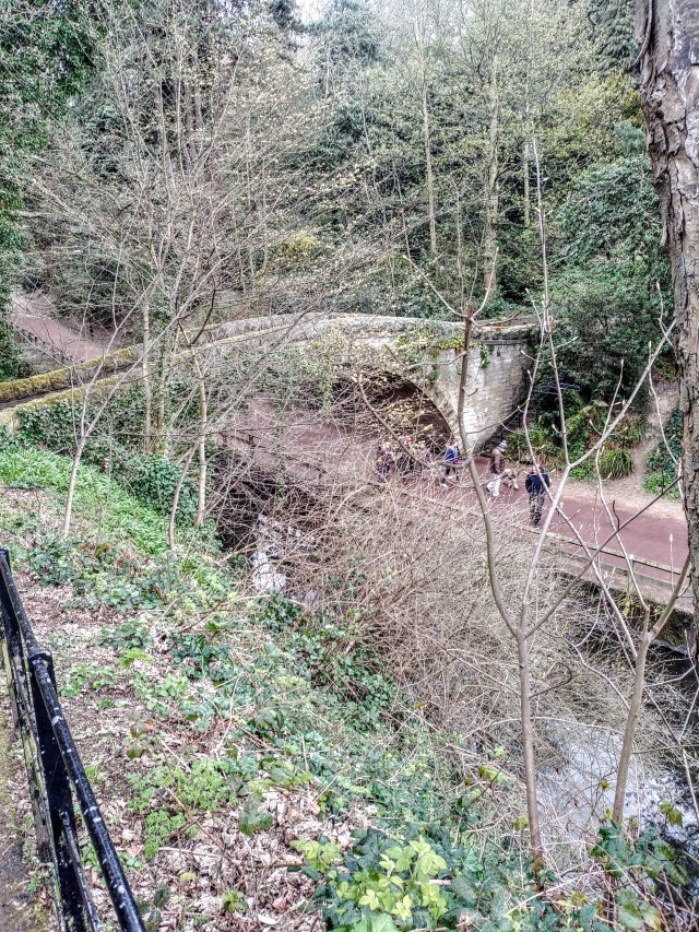
So off we strode in fine, dry weather heading east and turning down a lovely lane right past the Glebe Cottage Tearoom (more of that later!). The lane is part of the Cleveland Way and took us over the river Leven heading north west. The lane sloped uphill to a number of small cottages and then headed off in a north easterly direction. We struck off westwards via a footpath through Bankside woodland.

woodland walk

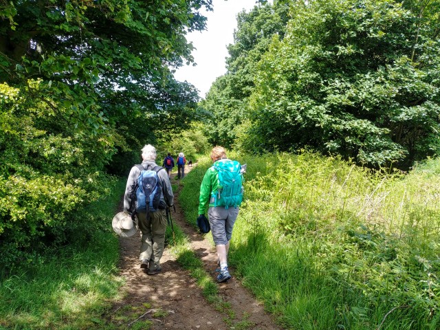
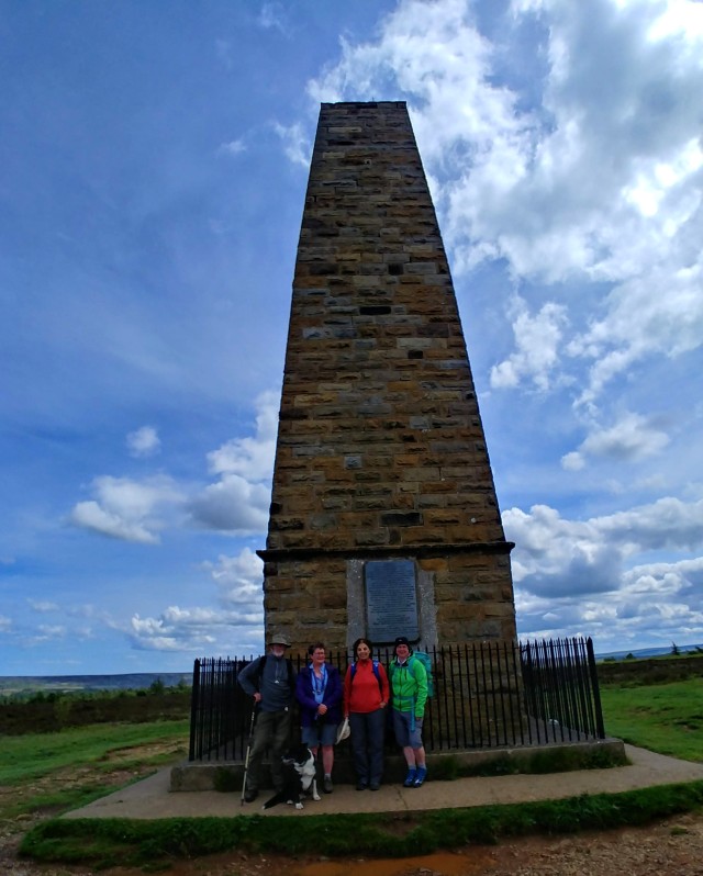
After following a rough footpath, we stopped for a break on the low slung branches of a half fallen beech tree. It was then a very steep scramble up a brambly slope to pick up the well maintained footpath up to Captain Cook’s monument.

cooks monument

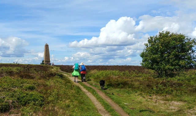
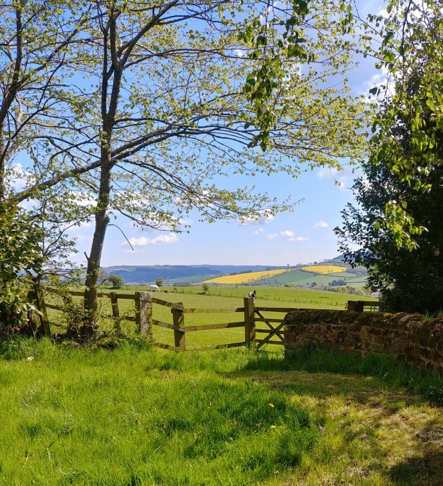
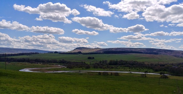
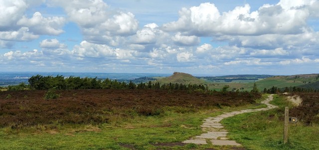
On this clear day the lofty position of this monument offered us fantastic panoramic views of what looked like most of the north east of England! Across to the coast, up to Sunderland, west to the Yorkshire hills. Amazing.

captain cook monument

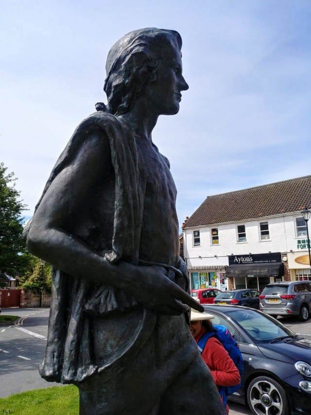
We then descended to the beautiful village of Great Ayton which was full of local day trippers. It’s got a lovely big village green, a famous ice cream shop (very busy) and a renowned pie shop (which was sadly closed). Tucked into one corner is also the small Captain Cook museum, a lovely volunteer-run attraction that details the life and times of this astonishing navigator and explorer. It’s a lovely place and well worth a visit if you get the chance.

captain cook

Lunch was taken in the gentle shade of a lofty lime tree on the village green before we headed back to Kildale Station and a nice cup of tea and a delicious slice of cake at Glebe Cottage Tearoom before the drive home.

5 miles


Posted in 5 miles, hill, moor, north yorkshire, railway, summer, tea shop, Walks | Leave a comment

Afternoon Delights in Two Parts 26th May

hartburn dene

As the days lengthen, we have more daylight available in the afternoons and one of our group can contribute walks. Due to work rotas he can no longer come along to Saturday or Sunday morning walks with us and so summer months give him the opportunity to lead short afternoon walks.

Today we found ourselves in Northumberland, up at Hartburn, near Scots Gap – one of his favourite walking spots – for the first of two short circular walks. We had a good turnout as well which meant that room on the slender roadside parking area was at a premium. We managed nonetheless.

This first walk took us down into a steep sided wooded valley with the Hart Burn wending its way at the bottom. The descent was pretty steep to the footpath in the valley where it was cool and sheltered from the blustery wind that was blowing.

sign

The valley was full of flowering wild garlic, their white flowers contrasting with the lush green, pungent foliage. Our walk took us to a partially dammed section of the Hart Burn that was used as a Victorian bathing pond. Nearby was an intriguing structure, carved into the rock that acted as a changing room, complete with covered walkway for lady bathers to discretely enter the water.

changing room

This first walk was only about two miles and we finished it relatively quickly.

The second walk was a short drive along the B6343 which inevitably caused confusion and a few wrong turnings along the way! After regrouping and meeting up at the start point we headed off around the countryside at Mitford village. This affluent area lies on the western edges of Morpeth town and contains a good sprinkling of expensive looking houses.

At the very beginning of the walk lies the ruins of Mitford Castle, an imposing structure that sits atop a high mound and commands a good defensive site. At its foot is the course of the Park Burn that looks to have dried up to no more than a marshy track but no doubt was a useful barrier when the castle was first built.

mitford castle

Walking through nearby sheep pasture we circled the castle eastward through lush early summer greenery and stopped for a snack beside the remains of a felled beech tree, its trunk cut into segments like a giant child’s toy.

logs

The final leg of the walk took us back to the village and our cars.

2 miles + 2 miles

Posted in 2miles, castle, northumberland, river, Walks, woodland | Leave a comment

The depths of Northumbria May 12th Hepple Bridge

copquet valley

If our last walk took us to the hidden corners of Weardale, this walk took us to equivalent territory in Northumberland. We are seasoned walkers within the beautiful Tyne valley and coast but only occasionally venture to the northern reaches of Northumberland.

This particular walk started out on the outskirts of the village of Hepple. It’s about eight miles from Rothbury on the B6341 and lies within the snaking coils of the River Coquet. The first section of the walk took us across and up a steep cow pasture to a small group of houses on the western edge of the village; one of the houses had a shed painted like Dr Who’s Tardis in the garden. Or was it the actual Tardis? Curving around the houses we passed an impressive barn conversion among some farm buildings and followed the path through the farmyard and onto a dirt track. This led us out onto sheep pasture overlooking the Coquet Valley and superb views.

hepple bridge

The river is slow moving and circuitous at this point and you can clearly see ox-bow lakes forming and flashbacks from geography textbooks! We wound our way slowly and diagonally through the steep sided pasture and down to the flood plain of the river, following a footpath to a wooden bridge over the Coquet. Instead of crossing the bridge we continued up and over rising ground to the tiny village of Sharpeton. At a roadside bench we ate our lunch and watched the Northumbrian world go by.

coquet river

After lunch we head for the hamlet of Holystone and the enchanting Lady’s Well. This ancient spring has been adapted from Roman times through to the middle ages and is now a shaded grove containing a rectangular pool and a small stone statue. The spring is still the water source for the houses nearby amazingly. It’s very atmospheric and a lovely place to rest on a long hot walk.

ladys well

Retracing our steps through Holystone we headed back to the bridge we eschewed, earlier on the walk, and crossed it to reach the far side of the river. After a short but steep climb we reached a higher footpath that skirted the top of the valley and ran alongside two large conifer copses.

This led us to a long farm lane that sloped gently downhill between hedgerows fresh with the greenery of new spring and back down to the roadside parking where we had left our cars.

7 miles


Posted in 7 miles, hill, northumberland, river, Walks | Leave a comment

Weardale Walking 28th April 2019

weardale

I’ve said it before and I’ll say it again; Weardale is glorious walking country. It’s relatively unknown outside of the North East and consequently relatively untrodden. That’s a good thing but also something that limits its prosperity. The villages are small and not so affluent as other parts of the North East and a bit more tourist money would probably be a good thing for local businesses.

Anyway, do try and explore Weardale if you get the chance – you won’t be disappointed.

Our walk began in the small village hall (?) car park hidden behind the Hare & Hounds pub and then over a small bridge. From here we walked back to the main A689 road and then headed north, threading our way up a narrow lane and then a footpath squeezed between two cottages.

Picking up the narrow valley of the Middlehope Burn we continued northwards and upwards along a good footpath. Spring can come late to this corner of the country and there was still a sprinkling of flowers amongst the hedgerows and the stream bank; primroses and mountain violas shining against the intense emerald green of mosses.

primrose middlehope burn

We passed through the remains of Slitt Mine with some impressive stonework still standing, an information board showed the extent of the lead mining operation here in the late 19th century. Now it is a peaceful spot and a good place for a picnic stop but in its heyday it would have been noisy, smoky and dangerous.

mine working weardale

Continuing on along the burn-side footpath we passed further evidence of the areas industrial past with grassy hummocks covering up crumbling walls and foundations. It was a clear, dry day and the wide open spaces were filled with birdsong and the gentle sound of the Middlehope Burn tumbling over its rocky stream bed. It really felt like Spring had arrived and we were enjoying the burgeoning daylight and the [slightly] warmer temperatures.

Our walk then took us up a long uphill section of farm track to avoid the usual route which had become waterlogged, muddy and very boggy. This detour added about one mile onto the walk and as it was all uphill, it was a bit of a slog and we stopped at a suitable stone wall to enjoy our lunch, serenaded by a skylark.

After our fortification we continued the walk, on a minor road, that brought us slowly back down into the broad valley of the River Wear. The farm track on the final stretch down to the river was stony and uneven and a bit of a test of ageing knees but we survived.

The final leg of the walk took us alongside the Wear on a particularly beautiful stretch of river complete with elegant waterfall and comfortable seating spot.

wear waterfall

7 miles

Posted in 7 miles, hill, muddy, river, weardale | Leave a comment

Urban Walk in Jesmond Dene April 14th 2019

jesmond dene bridge 2

If you don’t know Jesmond Dene in Newcastle then for me to call this an urban walk is a bit misleading. The Dene is beloved of Newcastle folk as an oasis of calm, green tranquillity in the heart of their big bustling city. It’s a steep sided, tree lined valley of the Ouseburn, that runs into the river Tyne in the suburbs of Newcastle. It’s as urban as it is rural to be honest. Its past is punctuated by small scale industry (a quarry, a water mill and a pit) but in its pomp it was a place for rest and relaxation for Tynesiders.

We met for this walk on Armstrong Bridge on a slightly chilly, slightly grey morning. The iron bridge, opened in 1871, overlooks the Dene from about 20m and is a well-known landmark.

It’s a bit difficult to recount a step by step travelogue of this walk as we meandered leisurely through the Dene using the many footpaths that criss-cross the area. The Dene is well used by local joggers, dog walkers and folks just out for a stroll as it is easy going, mostly dry underfoot and impossible to get lost.

There’s a small but well maintained children’s’ zoo in the Dene that we visited at first, to see the budgies, the rabbits and such like. After that, in drizzly rain, we headed North along the Red Walk that runs alongside the Ouseburn river. The pathways are all well maintained and surfaced – ideal for families and so for us the walking was easy and leisurely.

We visited the site of the old flour mill that is now just a crumbling folly thanks to Lord Armstrong changing the bed of the river so that he could have a waterfall to admire! The Dene was originally his own private park for many years until he allowed public access to it in 1883 but not before he had moulded it to his own tastes.

jesmond dene waterfall

On the upper level of the Dene is the remains of a fine banqueting house, known as Lord Armstrong’s Banqueting House, and used by the local nobility  for balls and fancy dinners. It is long since abandoned and is now a managed shell but inside we met members of the Jesmond Dene Friends who are trying to restore the building to a usable state.

newcastle crest

We climbed out of the Dene to nearby Paddy Freeman’s Park for our picnic lunch and enjoyed a spot of brighter, drier weather. After a further foray into the Dene to visit the fascinating ruin of St Mary’s Chapel, a site with a rich religious heritage, we took our leave of the Dene for a cup of tea at a local cafe.

5 miles


Posted in 5 miles, bridge, newcastle, ramblers, river, urban, Walks | Leave a comment

A walking weekend in Berwick 5th – 7th April 2019

berwick bridge

It’s been a couple of years (or more) since we had a group weekend away. School exams for kids, YHA ‘issues’ and other stuff has seemed to get in the way but this year we managed it.

I’ve been through Berwick many times on the train and it always looked like an interesting town to visit and so this weekend trip was one to look forward to. We arrived at the Berwick YHA at about 5pm and were immediately impressed by it. There’s a vibrancy and liveliness about it that is often lacking in other hostels we’ve been to. This is due in large part to the ground floor café that is open to the public and very welcoming. The staff are amazing!

The building itself is a stunner and well worth a look; an abandoned granary that has had a new skeleton built inside the extant walls and now provides three floors of excellent accommodation, a floor with a fantastic self-catering kitchen and diner as well as an arts space on another floor.

Our Saturday walk was a tricky affair; a linear walk along the beach that necessitated cars taken to the end point and drivers brought back again. A bit like one of those puzzles where you need to cross a river with a fox, a goose and a bag of corn.

We started out on the beach just south of Spittal on a bit of a bleak, overcast day with rain in the air. Nonetheless, our group of eleven hardy souls strode confidently southwards across the flat sandy beach as the tide continued to ebb.

berwick beach 2

The beach here is bounded by undulating grassy sand dunes so typical of the fabulous Northumberland coast and we made occasional forays into their grassy environs to avoid deep channels and large rock pools barring our way. Quite a few streams run directly into the sea on this stretch of coast and we did have to venture about a quarter of a mile inland at one point to cross a channel via a flood gate. We had lunch beside a collection of concrete cubes and we couldn’t decide whether they were tank barriers or [badly implemented] tidal protection.

berwick beach 1

Our walk continued south after lunch and the weather brightened, the rain eased off and we completed about 8 miles back to our cars at the excellent Barn at the Beal café. Highly recommended!

Our Sunday walk was much shorter but had much more content. We opted to walk the walls around the old town and mix in the Lowry Trail as well. The walls are fully intact and quite fantastic, a must-see if you’re in the town. A mix of walls and earthen embankments they protected the town from a whole host of ne’er-do-wells in days gone by; both from the sea and from land. There are old gun positions still visible and one or two replica guns in place to give you an idea of what it must have looked like. The Lowry Trail is an interesting view of what LS Lowry would have seen and what inspired his paintings. There are several information boards dotted across the town that explain his time here in greater detail

berwick lighthouse

On our way along the walls at the harbour mouth we took a detour along the pier to the old lighthouse. It stands tall against the buffeting wind and is an impressive sight in itself. Unfortunately, you can’t go inside but when you look back at the town you get a fine view of the higgledy-piggledy layout.

berwick 1

Inside the old barracks gym was an exhibition consisting of a scale model of the old wooden pier which was mesmerising. Inside the old wooden building was sparse and bare, with the elegant tracery of the wooden pier dominating the void. I loved it.

berwick exhibition

After the walk we headed back to the hostel and they allowed us to eat our lunch in the unused conference space on floor 1 – what a lovely bunch.

We browsed the art display in a leisurely fashion before packing up and heading home after a great weekend.


Posted in coast, northumberland, ramblers, river, urban, Walks | Leave a comment

My favourite Allen valley walk 17th March 2019

colliery lane

One of the perks of being a Walks Coordinator is that you can schedule your favourite walk on your birthday! Hence, this walk in the lovely valley of the river East Allen. We do this walk regularly and it never fails to be enjoyable.

On this particular outing we had a good turnout of around a dozen walkers on a fine if somewhat cool Sunday morning. This walk previously started in the car park of the East Allen Regeneration Centre but unfortunately that walled-in area is only open on weekdays therefore roadside parking is necessary.

Crossing the nearby bridge over the East Allen we entered a woodland path that ran parallel to the fast flowing river.

east allen bridge

This lovely path took us nearly a mile along the valley, crossing Isaac’s tea Trail, before exiting into sheep pasture a little further on and still alongside the river. The footpath passes through the lovely garden of an isolated farmhouse before continuing its partnership with the river and passing through another patch of woodland. A little further on we passed by another isolated stone house; well-kept and with another well-tended garden before continuing along a dusty lane to a bridge that links Appletree Bank and Colliery Lane.

This is a lovely, well-made stone bridge that suggests that in previous times a good solid bridge was needed to transport something along these lanes. We head up Colliery Lane which is a steep, high banked and metalled road with drainage channels either side. It’s a tough little climb but the surrounding flora and fauna is worth the effort in springtime.

Near the top of the rise we stop for lunch under the remnants of a railway bridge that passed over the lane. The bridge over the road has long gone but the stone abutments are still there and the nearby grassy verge is a sheltered and comfortable place for a sandwich and a cup of tea.

lunch stop

A little further up the lane is a stile on the right – quite a climb up to it due to the sunken lane but once over you get fantastic views down the valley with rolling hills inscribed with stone walls and the village of Catton nestled at the bottom. From here on in it’s all downhill; literally.

We criss-crossed about half a dozen fields and then followed a semi-overgrown lane down past a stone barn to the riverside woodland again. It was a bit of a steep descent but after that it was easy walking back to the parking spot.

5 miles

Posted in 5 miles, bridge, hill, northumberland, river, Spring, Walks | Leave a comment

Craghead; where Hollywood meets County Durham: 3rd March 2019

craghead

That intriguing title has worked as clickbait hasn’t it?

This walk, around the Stanley area of County Durham, passed by a local character who went on to become a big cheese in Hollywood so read on for more!

We started out from the home of one of our walking group and followed a route that threaded its way through houses that now sit where industry was once dominant. We were quickly walking into neighbouring countryside that skirts the area around Stanley. Still slowly waking from Winter slumber, the area was a sea of dun coloured grasses overlaid by a pale grey sky – typical March weather!

This first section of the walk headed up to the small hamlet of Craghead overlooking Stanley. Once a bigger mining village, it is still a thriving community and you can still see the footprint of the wagon way that once ran through here, taking coal to nearby distribution yards and on to coastal ports. The coal industry has made way for modern wind turbines that stand tall and skeletal against the skyline.

turbine

Craghead was the birthplace of David Horsley who emigrated to America in 1884 with his extended family to start a new life. Here he set up a bicycle making business and ran a pool hall before setting up the Centaur Film Company with Charles Gorman and his brother William Horsley. They eventually moved their film company to California in order to take advantage of the sunny, dry weather and the rest is history.

sculpture

Sculpture commemorating mining heritage

From Craghead we headed South East down a quiet local road called Wagtail Lane before heading North again and completing our five mile loop back in South Moor.


6 miles

Posted in 6 miles, durham, hill, railway, sculpture, urban, winter | Leave a comment

A Stamfordham Ramble 17th February 2019

farm track

I can honestly say that I have never walked around the village of Stamfordham. Indeed, I have never been to Stamfordham before we did this walk despite it being a few miles from our house.

It’s a surprisingly big village with a lovely spacious village green which was the start of our walk today. We headed out of the village by way of the footpath that loops around the lovely church of St Mary before heading out into farmland.

st marys stamfordham

It was a bright and breezy day, not too cold for February and good walking weather. Following the footpath markers, we walked West, down a grassy lane between fields before a short spell of road walking and then cutting through a small hamlet after a mile or so. After crossing the Fenwick Burn and a bit of a wrong turn through a badly way marked field, followed by a dainty hop over an electric fence, we passed through a large farmyard and back out into open fields.

It’s fairly flat around this part of Northumberland and so we tucked ourselves behind a stone wall for shelter and ate our lunch. We were lucky enough to catch a bit of winter sunshine here and some bird song for a lunchtime cabaret. It was a bit chilly though so we didn’t hang around for long.

farm track

We headed back towards Stamfordham before we were close enough to nearby Matfen Hall to hear the thwack of expensive golf clubs, following quiet roads and country lanes for the most part. We did pass through an enormously heavy metal gate that led from open pasture onto a local road. It was obviously a relic of a grander age and was crowned by a pair of impressive carved stone gateposts.

gate post


7.5 miles

Posted in 7.5 miles, church, farm, northumberland, ramblers, winter | Leave a comment

Newcastle Historic Walk 3rd February 2019

tyne bridges

One of our occasional urban walks.

With a programme theme of Local Heroes, a saunter around the centre of Newcastle offered us the chance to explore the historical figures that loom large in the list of Newcastle inhabitants.

We started out at Grey’s Monument, the towering 40m column crowned by a handsome statue of Charles, 2nd Earl Grey. It bears an uncanny resemblance to Nelson’s Column in London and was created by the same sculptor, Edward Hodges Bailey. Grey was a local landowner and politician famous for assisting in the passing of the Great Reform Act of 1832.

We headed off south, down the slope of Grey Street, a very handsome street in the middle of what is known as Grainger Town. Richard Grainger was a developer who cleared and replaced 36 hectares of crumbling, rambling buildings with his vision of classical architecture in the 18th century.

We turned right into Mosley Street, the first in the world to be lit by electric street lights in 1879, and headed up to cathedral square to take in a fine statue of Queen Victoria. Ducking behind the cathedral itself into a narrow cobbled street, we came upon a small bust in a wall niche to commemorate the site of where Thomas Bewick’s workshop once stood.

bewick

Heading past the remains of the Castle at Black Gate, we crossed the Tyne via the High Level Bridge; designed by Robert Stephenson and built by local engineers, the Hawks family. After a restorative break in the Arch16 café, we returned across the bridge and descended one of the many stairways down to the quayside.

nigh level bridge

After a leisurely stroll amongst the market stalls we headed back up the steep streets towards the railway station and the handsome statue of George Stephenson the railway pioneer. From there it was a short stroll to another statue, that of Joseph Cowen, a radical liberalist politician of the 1870s.

We sneaked inside the remains of the city walls and ended our walk by exploring the monastic heritage of Blackfriars restaurant.

4 ½ miles

Posted in 5 miles, bridge, castle, newcastle, railway, ramblers, urban | Leave a comment